Tuesday, September 7, 2010

Segment 7

Goldhill Trailhead to Copper Mountain


This is the last good meadow to camp in, before the ridge. The saddle you head to is on the left.


Looking back to treeline from the saddle at 6.5.


Copper Mountain, from around mile 9.


"Honey, come here and see this!"

I'd just managed to outrun a thunderstorm, was headed down off the crest of the Tenmile range as fast as my shaking legs would carry me, and here was a family... headed up the slope. "Look honey! This girl is hiking the Colorado Trail! Did you come all the way from Denver? Honey, she came all the way from Denver! I can't even get these kids to walk up a hill for a picnic without them complaining. Why, they..." panting and making their way as best they could, the aforementioned children, trailed by their portly mother, joined us. They were walking cross-country, off the smooth trail, evidently in an effort to shortcut the path's many switchbacks. They each carried a near-empty pint water bottle, their father wore a tiny daypack. Thunder rumbled behind me.

"Uhm," I said, getting out my nalgene. "Do you folks need some water? And, err. It kind of looks like rain, doesn't it?"

The gentleman said that it did, and that he hoped the top of this hill was pretty close, so they could have their picnic soon. I eventually left them, with refilled bottles and a cautious reminder about lightning. A half hour later, just as I was getting to thick tree cover, the skies broke open and poured rain for a good twenty minutes. Hope the picnic-ers made it down alright.

Actually, I got a shamefully late start that morning – it would have been far wiser to start early and get over the ridge long before any chance of afternoon storms. The alpine walk is beautiful at any time of the day, however – there were pikas aplenty, as well as two species I've never seen before: a marmot and a couple of ptarmigan with chicks. I kind of didn't think either animal actually existed, thought maybe they were legendary. Or imaginary. Or extinct. But there they were, living happily at twelve thousand feet, in one of the toughest environments on earth.

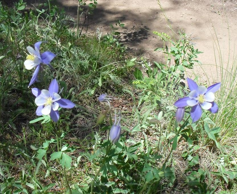
Also flourishing were columbines and sunflowers – the plants themselves were stunted and dwarfed, but their flowers were full-sized, and produced in such abundance it looked like each plant was balancing a bouquet overhead. Just gorgeous!


Stones into flowers.


Not all columbines were Colorado blue. This cluster was a beautiful pearly-pink lavender.


Guidebook update suggestions:

0.0
After crossing the big road, head over the bridge to your right. A little later, head left.

0.2
The blue diamonds which mark the trail start showing up pretty early along the way. You'll see the usual blazes, white plastic markers, and these blue diamonds for the next little while. Other than that little change, the trail has become easier to follow than indicated in the ‘07 guidebook – the intersecting trails are usually small and the proper direction clearly marked.

3.4
This sign hasn't improved, though. You still join the 'peaks' trail to the left.

5.5
I camped here, but should have continued an extra half mile or so, to the large meadow with a stream running through it.

6.2
You leave the last good campsite at a point where the road heads left, away from a pretty meadow, towards a saddle, up a very steep grade. After that meadow, the terrain is very exposed. You'll be the tallest thing on the ridge in the event of an afternoon thunder storm.

7.6
This water source was just a muted trickle, barely audible beneath the talus. I think it's usually a snow-fed spring. Don't count on it later in the season -- it's not far to the next spring, though.

9.0
This snow-fed spring still had plenty of snow to feed it. Very tasty!

12.5
The trail has been rerouted to the left after you cross the bridge, due to new construction. The way is clearly marked and fenced with orange mesh.

The elevation profile is basically correct for this segment.

--->Onward, to Segment 8!

Segment 6

Kenosha Pass to Goldhill Trailhead


Deadman creek, mile 4.5. Scary name but tasty water!


Masses of flowers amongst the stunted evergreens growing near Georgia pass.


The pack takes a little break near the crest of Georgia pass. I should really take the laundry in.


Where it passes across the divide, the trail is easy to follow. The track is worn deep in alpine soil, and the way is additionally marked by very long poles. I wouldn't want to be caught up here in winter snows!


Clearcut and replanted sections around Swan creek are like strange little bleak, hot Christmas-tree farms.


The clearcuts aren't large, though, and soon give way to mossy old-growth along ridgelines.


This is the longest segment of the Colorado Trail, but is thoroughly pleasant. The first eight miles or so pass through open parks and dense, fragrant forest. Some of the downed trees are 5' tall - in cross-section and after years of weathering – some of the living trees are broader still. There was plenty of water this year, too. I actually filled all my reserve bottles and hauled some five liters over Georgia pass, thinking I'd consume much more water on the climb than turns out to be humanly possible. Don't do this. Really.

The views from Georgia pass were splendid, and the alpine zone was carpeted in flowers. It's well-worth the climb. Many hikers see mountain goats, too – all I saw were dirtbikers roaring up and down the alpine hilltops. It does feel a little strange, to work for so long to attain a summit, only to find that others got themselves there with staggeringly little effort. Guess that's how things go, sometimes. ;)

From the swan river onwards, there's plenty of company. Especially amusing are the hard-core mountainbikers who also wear ipods, for they are fantastically oblivious. I had one gentleman pull his bike over, choose a handy tree, and urinate about fifteen feet from where I sat resting on a log. The ‘eep' he emitted when he turned to remount and found me (waving cheerfully) nearby would have done proud any twelve-year-old girl.

The miles of trail before Breckenridge are the setting for a big annual mountainbike race, on or around the 17th of July. I was fortunate to be able to get to town to enjoy the concurrent beer festival, but other hikers were not so lucky, and crawled into town with tales of clinging in desperation to trees on hillsides while scores of bikers barreled by.

Breckenridge was, I think, my second-favorite town along the trail. It's very tourist-y, but that means you can pick up some superb gourmet goods for the road, such as chocolate-peanutbutter pretzel bites, herb-crusted salamis, salmon jerky, artisan cheeses, enormous fresh-baked soft cookies, and more. Also, it has one of the best places to stay of any town – the Fireside Inn, run by the awesome, sweet, and helpful Niki. (Take the free bus all the way to the station at the end of the line, and then walk about four blocks south-east to the corner of French and Wellington streets.) They have two firendly standard poodles, a big leather couch and flatscreen for snoozing by the TV, showers with all kinds of gels and shampoos, dorm beds each with their own light, curtains, cubby, and bedding for 28 bucks, girls' and boys' rooms, internet, laundry, a fridge and microwave... and they're located two blocks from town center. Rooms are more expensive but a good option if you want your own space – but if you'll be arriving on a weekend, make absolutely certain to book your accommodation ahead of time. The place fills up very fast, and there's not much else that's affordable anywhere near town.


Plenty of flowers along the way, as always!


Long views approaching Breckenridge.


At long last, Breckenridge comes into sight in the distance. The dead trees in the foreground are victims of the pine beetle, the depredations of which are a widespread cause of concern.


Guidebook update suggestions:

0.0
Cross the big busy road, then head uphill from the parking area. The trail then starts off to your left, at a registry. There's supposed to be water at the campsites on both sides of the road, but I couldn't find it, and several people were also wandering around looking for the taps. Good luck.

2.2
Trail heads downhill through some aspens, beneath which was the biggest and thickest carpet of Colorado-blue columbines I ever saw on the trail. Hope your camera batteries are holding up.

3.1
Camped beside the large stream here – there are several nice sites in the area, including some big ones that can easily be accessed by car. This makes them the favorite stomping grounds of ATV enthusiasts. Which isn't all bad – I traded a bag of marshmallows for some much-needed bug spray and aspirin at one of their campsites.

~7.0
The climb up to Georgia pass is long and even, and was also better-watered this year than the books indicate. Many supposedly ‘waterless' campsites were in fact served by picturesque little trickles.

14.2
Several lovely (but actually waterless) campsites are near the trail a couple miles after Georgia pass, just where the trail turns west and starts its long descent off the mountain.

~19
Swan river has an extensive campground and, especially around the streams, many confusing side paths and dirt roads. Stay alert for markers.

26.0
The guide/databook instructions for the last potion of the trail is confusing, but in actuality, the trail is very easy to follow. The occasional side trails are much smaller than the CT and are clearly not maintained to the same standard.

~28
The hummingbirds toward Breckenridge are pushy little monsters. Got a bright orange piece of gear? The little suckers will fly right into your tent to check it out. Also, never ever wear a red hat.

32.9
The bus into Breckenridge was running every hour at ten minutes to the hour (3:50, 4:50, etc) in the afternoons/evenings, and ever half hour (7:20, 7:50, 8:20, etc) in the early morning. They also list their schedule online, if you want to double check.

The elevation profile for this segment is roughly correct. However – and unusually for databook elevation profiles – it is *not* as bad as it looks. The segment is just very long, so the profile is horizontally compressed. Climbs are switchbacked and the trail is quite smooth.

---> Onward, to segment 7!

Segment 5

Long Gulch to Kenosha Pass


Cows, out happily besmirchin' the water supply.


The views past Johnson Gulch seem endless.


Segment five meanders along from dry hillsides to merry little streams to flower-crowded hilltops with sweeping views... of South Park. That last fact alone provided me endless entertainment for a solid two days. This portion of the trail seemed to have its own share of characters, too – a gentleman who chose to hike in a kilt and nothing more, a man training rescue dogs to pull sleds and cross-country skiers, two riders on gorgeous matched palomino horses who gave me carrot sticks and pretzels (thank you!), and even a little yellow bird which rode my atop my pack for a couple paces (evidently I substantially resembled a buffalo.)

I dropped by the little town of Jefferson for a little more food and some iodine tablets -- I bought their only bottle. Sorry. The general store/post office is a marvel, managing to pack an enormous range and variety of goods into a dimly-lit area the size of a Peace Corps volunteer's mud hut. Their locally baked goods are divine after a week on the trail – be sure to pick up a couple bricks of homemade fudge. Hitching into town was quick, and the gentleman who picked me up even took me back out to the trail – thank you, Kirk!


Indian paintbrush, among a multitude of other wildflowers, was in full and riotous bloom.


An... unusual marked cairn on the last couple rolling hills near Jefferson.


Columbines were in mass bloom towards the end of the trail.


Guidebook update suggestions:

4.7
Camped here, on a little rise between ‘seasonal' streams, all of which were burbling happily.

7-9
There were strange noises occasionally throughout this segment, something like sucking up jello through a straw. At long last, I discovered what this was due to. Emitting that noise, two military planes came roaring over a hill and down a valley, hugging the treetops.

8.4
Johnson Gulch was full of cattle – the water there did, ah, not look clean. That's a pity, for the next seven miles were indeed without other sources of water.


The elevation profile was roughly correct for this segment.

----> Onward, to Segment 6!

Segment 4

FS560 to Long Gulch


The lost creek wilderness!


Do you realize that you are not, in fact, allowed to bring hang gliders into national wilderness areas? Why not, for goodness sakes? I mean, if someone really wants to haul a hang glider up and down mountainsides, by foot (wheeled vehicles are not permitted), then climb up a tree and fling themselves and it off -- who are we to stop them? Honestly.


The segment starts out following an old road through a dry, dense pine forest.


But it soon dips through a series of small, well-watered valleys, thick with aspens so enormous I couldn't reach around them.


This segment should be renamed. No longer shall it be called ‘four', but rather, ‘mosquitotown.' By mid-July, most of the biggest swarms of bugs elsewhere on the trail have vanished, but not here, oh no, definitely not here. You'll be treated to mosquitoes up your nose, in your socks, stuck to your glasses. If you slow down – to rescue a boot form the mud, for example, or to attempt to do some laundry – the bloodsucking horde will amass to life-threatening thickness. Hikers who find your body, hours later, will believe you were slain by vampires. You do not want that.

Because of this airborne and pursuing menace, I made my best time so far – 11.3 entire miles in only ten hours. Yes, that is correct. Toddlers move faster; indeed, wheelchairs navigate stairs more quickly than I manage equivalent climbs. Guess it just goes to prove that pretty much anyone, no matter how out of shape, can complete the Colorado Trail – even at the handsome pace of one mile an hour.


At least finding the way is easy -- there's pretty much only one trail, and since only hikers and horsemen pass this way, everything is very well-marked. This is the turnoff at 5.6. Kind of hard to miss.


After the big climb, glimpses of Lost Creek's winding park are welcome indeed.


In Colorado, 'parks' are wide expanses of inexplicably clear grass and shrubland, bordered by dense pines.


Trickling little streams, as perfect as if they were installed by landscape designers, feed into Lost Creek.


The route ahead, from the lookout point at 14.6.


Guidebook update suggestions:

~2.0
For the next three miles or so, little streams are everywhere, turning whole sections of the trail into sucking mud puddles. Hope you've got those sandals – and extra bug spray!

5.0
Steep switchbacks up the mountainside.

8.9
Camped here, across the creek, near the trees. A very pleasant spot, with potential fishing from the meandering stream.

13.0
Though the guidebook calls this section boggy, many improvements have been made to the trail, and aside from a few muddy bits, it wasn't nearly so bad as the area down below.

14.5
New forest service gate.

The elevation profile for this segment is pretty much correct.

----> Onward, to Segment 5!

Monday, September 6, 2010

Segment 3

Colorado TH (FS550) to FS560


Segment three was carpeted with flowers in mid-July.


Thick sections of pine forest give way to little clearings filled with Indian paintbrush.


More traffic means that most of the trail is exceptionally well-maintained -- occasional wet sections are raised and bordered.


"But what will you do for food?" asked the concerned biker – it was perhaps the twentieth time I'd heard this question. There were more mountain bikers enjoying their weekend recreation on this segment than any other on the trail. Each was at least polite, calling out before they passed. Many were helpful, too, stopping to make sure I wasn't lost -- several were genuinely concerned about the fact that I was hiking in sandals -- and then falling into conversation. I quickly tired of explaining that I'd be stopping into towns for food and supplies every ninety miles or less.

"Oh, I figured I'd push mountain bikers over as they go by, and then make off with their supplies whenever I get hungry," I started admitting with a sheepish shrug. "Or maybe eat grubs and worms. But, frankly, I expect manna to fall from heaven." One lady biker looked very worried and gave me a Genisoy chocolate protein bar. Sorry about that, lady with the green stripy riding suit. That was supposed to be a joke. But I really, really appreciate the snack anyway.

Also, perhaps because of the heavy traffic through the first two-thirds of this segment, the triangle trail markers have suffered a certain amount of damage. Many are, sadly, missing. Fortunately, it's difficult to steal a blaze, and there are plenty of them. Look for scars like an upside-down exclamation mark, cut into the bark of trees along the way.

Walking in sandals from time to time was very pleasant, by the way, throughout the journey. I met several hikers in the first couple sections who eventually dropped out, due to blisters – each one wore heavy hiking boots, often new ones. There is no part of the Colorado Trail that cannot be traveled comfortably in a regular ‘ol pair of running shoes, or the increasingly popular light-boot/running-shoe hybrids, unless you have special foot issues. Just so you know.


The gun club road at 9.6 -- and yeah, shots were audible from time to time. Several signs warn you to stay on the trail.


I hauled a stove and fuel around for more than a month, but starting a little fire and cooking over coals is so much more fun....


Curried ramen with summer sausage and a toasted layer of sharp cheddar and smoked gouda cheese on top -- oh yeah!


Guidebook update suggestions:


1.3
This stream was dry – even though there had been a great deal of rain throughout the past weeks.

1.9
There are masses of bike trails through the first part of this segment, and also masses of bikers. Stay alert at intersections – all are well-marked, but if you get off the trail, you could wander a long time.

2.1
This stream was just a trickle through mud.

2.8
I camped here -- this was the first running water I came upon after the burn area. There are several great campsites nearby.

~4.0
There's a series of rocky outcrops around here which are ungroomed and rough, and look significantly unlike the rest of the trail, to the point that you might feel you've gotten lost. But you haven't. Just so you know.

7.6
The campground off to the left here has good clean water from a faucet near the dumpsters. But the toilets are closed and locked, alas.

8.0
Buffalo creek is more like a small river, and looked promising for fishing.

8.8
There's a new trail – Redskin mountain, I think – that goes straight, while the CT veers sharply left. Neither guidebook mentions this.

9.8
Camped here, on a neat little rocky bluff. Once you climb up from the river, the terrain is a long and pleasant rolling ridge, with many great flat camping spots. No water, though.

The elevation profile for this segment shows nearly flat terrain – but you'll still be doing plenty of climbing and descending over short distances.

----> Onward, to Segment 4!

Segment 2

South Platte Canyon to Colorado TH (FS550)


The burn area, as seen from near the end of segment one.


At the end of segment one, just after a long and steep descent, there is a forest service toilet. Like a beacon of hope and comfort, it beckoned me ever onwards. Oh, how I looked forward to that potty!

It was all the hummus' fault. I've never hiked a long trail before, you see, and knew little about what types of foods were appropriate for walking all day. Oh, I knew that foods should be high in calories-per-ounce, and I had a vague notion that a steady diet of twinkies would just not do. But beyond that? Nothing. So I packed dehydrated hummus, and also a packet of flax seed tortillas which, in flavor, were vaguely reminiscent of sawdust. In the supermarket, these items seemed lightweight and wholesome, and no doubt they are, in moderation. When consumed in volume, however, they tend to cause certain predictable side effects.

I'd brought along an entire roll of toilet paper, mind, but by the second day this was already vanishing fast. Worse, while I knew that I needed to dig catholes, I wasn't very good at actually hitting them. Or at choosing places appropriately concealed from the trail. There are few anguishes sharper than crouching in the bushes while a troop of about one billion boyscouts march by, keenly aware that if you stand you'll be spotted, and strongly suspecting that you may have pooped on your shoe.

But though the Waterton Canyon toilets were clean and fully stocked with paper, the little potty at the start of segment two was anything but. Trash -- including the packaging of high-end backpackers' dehydrated meals -- piled high in every corner, graffiti covered the walls, the smell was unspeakable. I was forced to flee back out into the rain. It's a shame that bypassers and campers would misuse a public facility so.

The rest of the hike was much more pleasant. The burn area is bleak, but it has its own lean beauty, and life is slowly returning, in pockets or in swaths. I met a little gopher snake sunning himself and helped him off the trail, and the hummingbirds were out in force. The guidebooks recommend an early start so as to avoid the heat of the afternoon, and this is a very good idea indeed on clear days.

Towards the end, there are several points where you must cross or follow dirt or paved roads. When you get to such intersections, pause a moment and look around – everything is well-marked but the signs or blazes may be across the road and/or not immediately obvious.


The burned zone -- bleak terrain after the mossy forests and fish-filled Platte river.


There are still wildflowers aplenty, some of which you're not likely to see for much of the rest of the trail. In especially dry, heat-blasted sites, young cactus are taking over.


An old quartz mine. Half-buried equipment still juts from the collapsed mound of the quarry.


Markers like this one frequently point the way. They're about four inches across and can be hard to spot, especially if half-sunk into the tree bark. Look for them a little above head-height.


Suggested updates to guidebook:

0.0
There's another forest service toilet here, before you cross the river, but enter with extreme caution. And don't get your hopes up. I didn't think even hockey players could trash a place this badly.

0.1
At the fork where you should head right, up the switchbacks leading to the burn area, the marker was missing. Just look for the spot where the trail heads south, uphill, past a ‘no camping here' sign.

1.0
Pair of old quartz mines off to the left. The remains of old equipment are interesting.

2.7
Patchy sections of unburned juniper, and eventually pine, forest start. Keep an eye open to the right – there's a cluster of young aspens somewhere around here which marks a muddy area about 200 feet off the trail. I suspect that, after recent rain, this might become a small spring. There are plenty of great flat camping spots with firewood, but other than this slim possibility, there's no water.

6.5
Enter larger burn area. There are strange bleached skeleton trees in places, and also interesting wildflowers and cacti.

9.0
There are some standing trees and patches as you approach the road – if you're crossing the burn in the afternoon, you'll be happy to see the shade. You may be able to spot some of the buildings of Buffalo Creek out to your right in the distance.

10.3
Pass through a weird, broken-down gate, then start a short, potentially confusing series of road crossings. When you get to road/trail intersections, take a moment and look around – correct trails are clearly marked, but sometimes only at a distance. You won't get lost if you stay alert.

11.5
The little fee area here has toilets, but we looked around and could not find a place to pay. The start of the next segment is just to the left, if you stand facing the Colorado trail info board.

The elevation profile is correct for this segment -- but as always, the portions which are drawn as flat are actually rolling hills, sometimes with steep bits.

----> Onward, to Segment 3!

Sunday, September 5, 2010

Segment 1

Kassler to South Platte Canyon


The info center has a great big map of the area. Check it out, just west of the buildings, if you're not quite sure where to go. Or just head south.


Fluffy baby goose chicks. Don't piss off their parents. Trust me on this one.


The first couple miles even have markers. That's two-point-five, by the way, not twenty-five. Yeah, I know, I got all excited too.


Water from the river is available at many, many points along the trail. Also, there are potties every mile or two. Nice.


There was company aplenty on this portion of the trail – especially the first nine miles. Dozens of boyscouts, runners, speed-walkers, little old ladies, mountain bikers, and dog-walkers all passed me handily. The wildlife didn't seem to mind the traffic – Canadian geese strolled down the road with their half-grown chicks, cormorants fanned their wings in the froth, hummingbirds and bright yellow finches flitted everywhere. I spotted two deer, one of which was licking a caretakers' driveway, and also encountered the single-most dangerous animal I spotted on the entire trail. Yep. There he is, down at the bottom. Terrifying.


The big dam. Waterton canyon is supposed to be closed soon for several years, in order to dredge out the silt building up behind this behemoth.


Mmm. Delicious driveway gravel.


This is the first bench. I believe it was placed here specifically to fool newbie hikers into thinking they've made it all the way up to Lenny's rest, when in fact they still have a monstrous climb 'twixt they and it. How devious!


The photo is deceptive: this beast must have been at least nine inches from head to tailtip, armed with black button eyes of cuteness and a snuffling pink nose. Who knows how many innocent hikers he's lured in for a closer peek -- hikers never thereafter heard from again? Truly, the wilds are a dangerous place.


Suggested updates to the 2009 databook:

0.0
Getting to Waterton canyon by bus from the airport was surprisingly easy. I arrived on a late evening plane, hung out at the airport sorting gear for a few hours, then took a bus at 4:15. A couple of transfers later, I arrived around 7:30, with a full day ahead for walking. The driver dropped me off perhaps a quarter mile from the information center at the start of the hike. Go to http://rtd-denver.com/, tell it you want to travel between a landmark (Denver International Airport) and an address (Waterton Canyon) and it'll provide the routes. Cost was something like nine bucks. There's a Colorado Trail bar and grill at the airport, and a Burger King where you can score all the little mustard and ketchup packets you could imagine a use for.

0.9
Travel down the main road until the trail – a small road in its own right -- branches off to the right. Or you can wander along a more scenic trail that winds through the info center and parking lots, but it ends up at the same branch.

3.2
Several caretakers' houses to the right.

~4.0
Small dam, then a series of hulking pieces of sand-filter and waterworks equipment.

6.6
Dam-caretakers' house. Keep to the right at the trail fork just beyond.

6.9
Small polished bench which appears to be Lenny's rest, but is not. The real one is up those switchbacks ahead.

7.9
Real Lenny's rest.

8.7
I camped here – nice spot. Supposedly this is the last reliable water for 8 miles; I found two other streams flowing strongly just up the trail. 2010 was a superb water year, however.

9.5
Very rocky, rough portions of trail – bikers have to hike their rides. Hope you've got trekking poles.

12.0
Cell phone service possible from some of these west-exposed rocky outcrops.

13.0
You can see the burned area you'll be crossing, down to the south.

The graphical elevation profile in the databook is not quite correct: you start to climb sooner, and go somewhat higher, than it indicates. Sorry.

----> Onward, to Segment 2!